tornado funnel cloud over nantwich

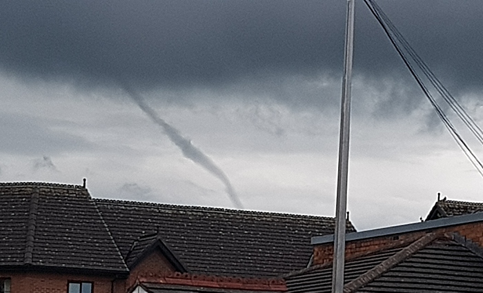
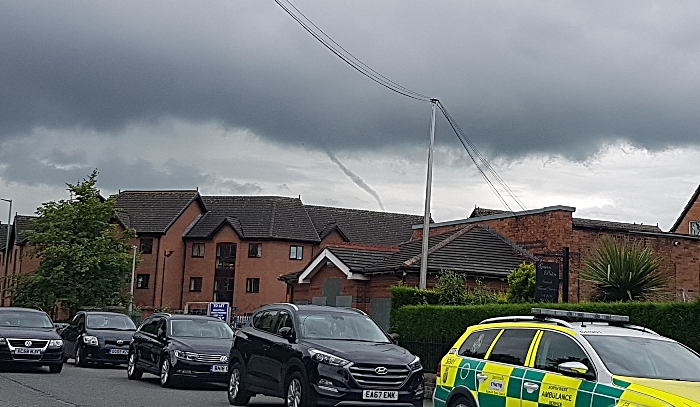
This spectacular funnel cloud was captured by a Nantwich photographer as it formed menacingly over the town today.

These images, taken from Barony Park area of Nantwich, show the funnel forming at the bottom of towering cumulonimbus storm clouds.

Funnel clouds are usually cone or needle shaped forming from condensed water droplets with a rotating column of wind.

They form most frequently in association with ‘supercell’ thunderstorms, and are the precursor to tornadoes.

Most tornadoes begin as funnel clouds, but some funnel clouds do not make surface contact and these are therefore not classed as tornadoes from the perspective of a naked eye observer.

It’s not clear whether this spectacular funnel cloud, photographed at around 12.45pm today (July 1), touched ground in or around Nantwich.

Nevertheless, it’s a rare and spectacular sight!

tornado funnel cloud in nantwich

Oi Sponsor us or else…

Lorem Ipsum is simply dummy text of the printing and typesetting industry. Lorem Ipsum has been the industry’s standard dummy text ever since the 1500s, when an unknown printer took a galley of type and scrambled it to make a type specimen book. It has survived not only five centuries, but also the leap into electronic typesetting, remaining essentially unchanged. It was popularised in the 1960s with the release of Letraset sheets containing Lorem Ipsum passages, and more recently with desktop publishing software like Aldus PageMaker including versions of Lorem Ipsum.

Contribute MonthlyContribute Once

Leave a Reply

Your email address will not be published. Required fields are marked *

By using this form you agree with the storage and handling of your data by this website, to learn more please read our privacy policy.

*

Captcha * Time limit is exhausted. Please reload CAPTCHA.